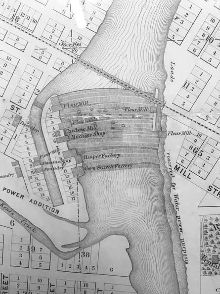
These channels called races were used to turn water wheels. The water wheels transferred power to pulleys that ran flour grinding mills on each side of the river. They also powered machines used to cut metal to make farm implements. Notice there was only one railroad crossing the river in this early map of the Water Power District.